Hmmm, usually when I write a blog post I just type away and then hit the publish button. I don't tend to plan anything, I just let it all flow as it were. The last couple of days though I haven't been feeling particularly perky, the keys are in the ignition but the engine isn't starting.
I had half hoped to get out for another ride today, I even prepared by only having toast last night instead of a more normal dinner (that's to do with the IBS, not eating much the night before makes life easier), and I also put on my scruffy riding clobber when I stumbled out of bed this morning. But with strong coffee failing to lift the general fuggy feeling, I stumbled back upstairs an hour later and changed back into my normal clothes.
I don't want to write yet another day off though, so I'm going to update the blog on the latest couple of rides, but as I'm not in a particularly word mongery mood either, this may not be up to even my usual low standard of guff. But I also don't want to fall behind with it all, so on we go and we'll see what falls out of my keyboard today.
Last Saturday, we'll start there to keep things in logical order.
Craig, my neighbour and fellow fatbiker (that's owner of a fat bike not a fat bike rider... oh you know...) had knocked asking if I fancied doing part of the Camel Trail from Bodmin up to Wenford Bridge, as the forecast looked promising. All agreed then, earlyish on Saturday morning we headed off into chilly but slowly warming sunshine, bound for Bodmin.

After a brief unscheduled tour of the town (they're doing roadworks and we got just a little lost, always a concerning situation in Bodmin, they're a funny lot up there...) we finally found the planned starting point of the car park behind The Borough Arms, on the A389 at Dunmere.

Craig and his Specialized Fatboy SE.
The Camel Trail (some general info here) is a chunky 17 miles from one end to t'other, but some sections are more popular than others, and the Bodmin to Wenford Bridge part is reasonably quiet.
Craig and I did ride the Wadebridge to Padstow section a couple of years ago, one sunny Saturday in August, and it was seemingly as busy as the M25, only with bikes, and erm... Mexican Bandits.

A couple of years back and it's busy biking on the Wadebridge to Padstow section of the Camel Trail. I was on the old Giant Hybrid I called Lump, 'cos it was one.

See... I told you... Mexican Bandits.
Anyway, after copping a load of bantery stick about how clean Fatso was compared to Craig's Spesh Fatboy, we headed off in a northerly direction following the old track bed along the wooded banks of the River Camel. Last time out on his Fatboy, Craig had the chain break rather spectacularly, trashing a couple of the rear sprockets in the process, bending teeth over somehow. Our helpful LBS decided that given the bike hadn't done many miles, this shouldn't have happened, so took the chain and cassette to send back to Specialised, and gave Craig new items free of charge, which is pretty good of them really. That meant Craig didn't have his original chain to compare lengths with, so this ride would be a test of his judgement skills in getting it set up correctly.
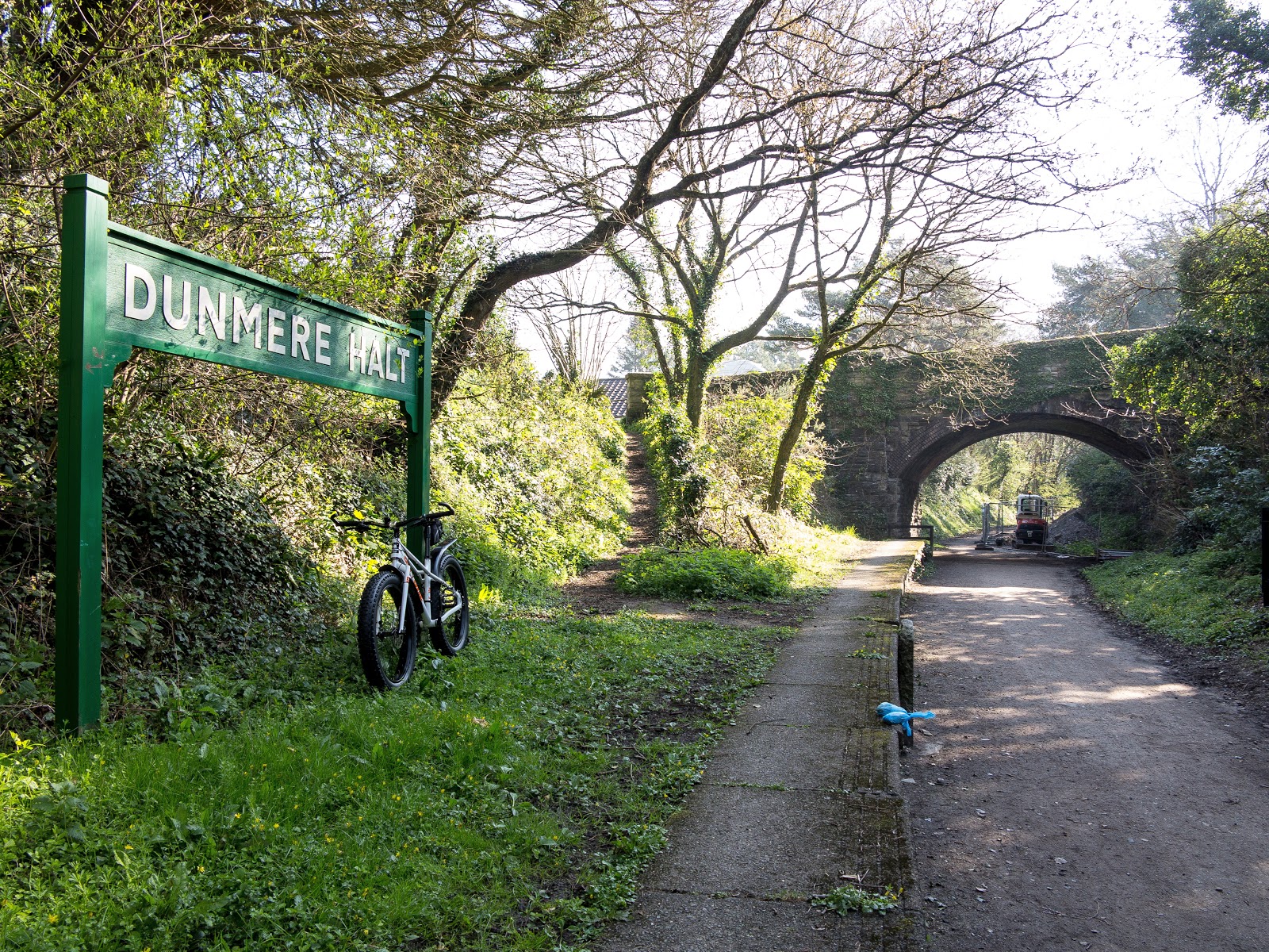
The Borough Arms car park is adjacent to the old Dunmere Halt station.


This section of the trail up to Wenford Bridge is very relaxing indeed, with the only sounds being the river down to the left in these shots, birds in the trees and a couple of fatbikes tooting along. The only trouble is, old Craig there is into keeping the pedals turning, and is not one for a lot of photo stops.
Back to the ride and it really was very pleasant indeed. The sun was out but the chill could still be felt, being both beneath trees and close to the river, but this was top bimbling for sure, boasting good weather, good company and a great setting. Mind you, not all people like to bimble along smelling the smells and drinking in the relaxing ambience, as we were overtaken a couple of times by some speedy folk going like the clappers, probably riding more with fitness in mind rather than 'nature therapy.'

Hmmmm... I'm one of those that think if you're carrying a single pannier, it should go on the right - the traffic side, to help make traffic give you a wider berth as it makes the bike look bigger (sort of). But anyway, here we are getting blown away by an even older oldie who was going like a Greyhound stung on the backside by a Wasp.
Wenford Bridge was reached soon enough even at our low velocities, and Craig picked a fight with a Bacon Sandwich and a piece of cake from the cafe there. The smells emanating from the cafe and Craig's plate served to make me rather hungry but I tend not to eat on rides, restricting myself only to emergency Jelly babies when I'm feeling pooped or faced with a monster hill to climb.

The cafe at Wenford Bridge.


Craig, taking care of business. Oh hang on... that's Brown Sauce... Uh - uh, Tomato Ketchup on a Bacon Sarnie surely?!
The Mancunian half of our little peleton suitably refueled, we headed back the way we'd come, this time enjoying the benefits of the slight downhill gradient. Craig's transmission had started making some noisy gear shifts, and also the front chain rings had sucked greedily at the chain on a couple of occasions too, but all seemed well enough to carry on and we made it back to the van without drama.

A very enjoyable ride indeed, and one to be recommended for anyone wanting a short off road ride, the round trip being a smidgen over 13 miles. One day hopefully, we'll do the full 34 mile, end to end round trip. Being all on old rail track bed, it's all easy riding so not such a bad ride as the distance might sound.
For anyone thinking of doing the trail, there is also the Bodmin and Wenford Railway to consider too, details of which can be found here
Bodmin has an awful lot going for it for a cyclist like me, and I'm just a bit jealous of all the riding on offer in the area, I must admit. Hmmm... wonder what it's like to live there...
So that was Saturday, and then there was Tuesday.
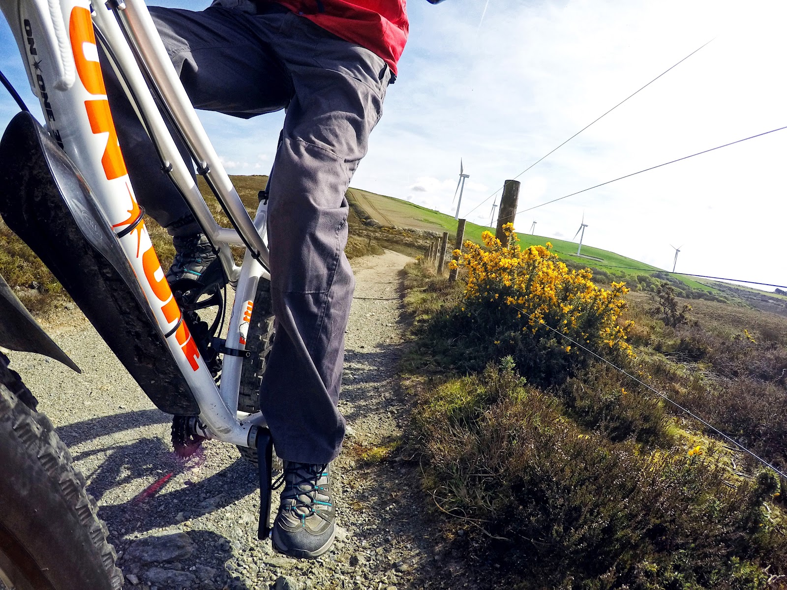
Another bright and sunny morning, and back to riding solo for me as I set off aiming for Newlyn Downs, site of the old Cargoll Mine, for some off road playing about. It is also home to the Carland Cross wind farm which dominates the skyline round hereabouts.
Newlyn Downs sits just north of the A30 at Carland Cross, just a couple of shotgun blasts from my home village of Trispen. Back when the mine as active, Trispen folk worked there too, despite it being a bit of a schlep to get there on foot or however they commuted back then.
Think of Cornish mines and you think of tin, but not all mines produced tin as their main resource, and Cargoll majored in Lead, Copper, Silver and Zinc. Underground mining ceased in 1870, but production continued briefly afterwards by working accumulated stock piles.
Today, the land is Public Access land as well as being an SSSI (Site of Special Scientific Interest) and an SAOC (Special Area of Conservation), it is also a GPFDA (Good Place For Dicking About). A lot of old mining sites boast the remains of the old engine houses and other buildings, but there is nothing but wasteland to see, and a few capped mine shafts. Some areas of the site are thick with Gorse which makes for some bush busting riding, while other parts are more akin to the surface of the moon. It all makes for some decent off road pottering about though, even for an oldie like me. I've been here on the old clanger Carrera, and the Voodoo, a couple of times before, but Fatso makes life much more fun when it comes to riding along some of the trenches that are to be found on site.
There's a brief Wikiwotsname piece on the Downs here and more on the Cargoll Mine here
Unfortunately, a couple of searches have failed to find any photos of the mine buildings (I did find one of me on the Carrera mooching about though...)
Right, enough words, time for a few yards of photos:

On the old A39 and now a Bridleway, up to Carland Cross. Newly aligned A39 on the left. Destination for the ride is in among the wind turbines over yonder hill.

White Daffodils still looking good in the fields, but must need picking pronto.
See those pylons and power lines there?

Here are the same power lines only now going over the lane that dog legs inland between Carland Cross and Mitchell. It's a long old way round to get to Newlyn Downs this way.

Fatso beneath the A30 at Mitchell.

Another endangered species these days, the lesser spotted wheel trim. Everyone's got alloys these days making these lost trims a less common roadside sight.
Getting to Newlyn Downs I took the long way round, which involves a right old dog leg to get to Mitchell, before taking the road to St Newlyn East, where the Downs are to be found about half way along on the left.


No... not that Mud... Tractory mud. Mud left on the road by a tractor...

Oh here we go. On a previous ride which took in a Bridleway through the Trewithen Estate at Probus, it was apparent they have a liking for signs and lots of do's and don't you dares. Another sign nearby warns that the snakes are Adders and to be careful in Thunderstorms. What with mine shafts to fall down and unexploded ordnance as well, (not sure where that comes from) it's a blinking dangerous sounding place...
Note the sign makes no mention of push bikes. It doesn't say you can't ride one in there so in I go!

Uh oh... bar end bush tangle danger... more power needed!


This site has different riding on offer, from bush busting narrow singletrack to open wastelands with ditches and ride along and gert mounds of spoil to ride over.

Plenty of these wider tracks to explore too.


The Downs are a Gorse enthusiasts delight.


Prime Adder country, and they're coming out of hibernation about now too...


Doing a manly man pose for the camera. This took ages as the sun went in having got everything set up, and with no wind to speak of, it took ages for it to come out from behind the small cloud it was hiding behind. Made me feel a right Wally posing there all that time it did...

There are lots of these dotted around the site, not gardening cloches, but capped mine shafts. You don't stamp your feet when it's cold round these parts I can tell you. These will be the shafts they know about, there are plenty they don't...
On the topic of random mine shafts opening up, there was a very spectacular one down the road at Scorrier last year. A shaft opened up in the back garden of a bungalow. Scary stuff! info and photos here


There's a lot of this barren looking landscape around too. Turbines forming Carland Cross windfarm are dotted about as well. It must be an eerie, creepy place at night, especially under a full moon, or when lit by lightning perhaps...
Leaving the site, I took the access road to the silos that are part of the overall site (and are a strict no fly zone - I don't know what's in them but they don't want people mooching about that's for sure) which leads out onto the road near Fiddlers Green, then home through the lanes meaning I went round in a big old loop.

Heading back out of the site up the access road for the turbines and also the strange silos that are on site. Possibly they were a munitions dump in the past.

Gert big spinny things dominate the view all around. They can be noisy beggars too when there's a breeze blowing.


Being on open land there's nothing much to scale the turbines against, and they don't look much in photos, but these things are flipping huge.

View over a hedge on the way back home.
So a decent and very enjoyable couple of rides. The weather is supposed to be a bit iffy tomorrow (Good Friday) but if I can get my act together I fancy a bit of a boot on the Jamis back round the lanes I tackled earlier this year, but on that occasion knackered my back when putting the chain back on. There's unfinished business there so fingers crossed I feel a bit more like it again.

Now this is a crappy map. It won't do intricate freehand lines it would appear. You can follow roads but that won't show off road elements, obviously. So you can select freehand but that just joins points up in straight lines, so all in all, not much cop, but there we go. Newlyn Downs starts at point six and extends around the area of the first straight line. The next bit, and where the arrow is, is where the access road to the silos is.
So, Google Maps might be a better bet if this link works. That should show the Downs bang in the middle of the image.
---------------
No comments:
Post a Comment